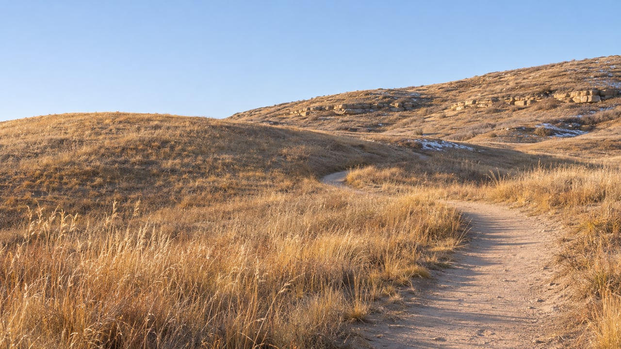
Lost Canyon Ranch Open Space opened on July 13, 2026, with about 10 miles of trail and a summer schedule that ran from 5:30 a.m. to 9 p.m. The first trail reports, including DougCo Social's guide, were mostly about the heat. The grassland loops have almost no shade, and hikers were told to come early or late and bring more water than they thought they'd need.
Things are different in November. The full trail network is finished, the property is larger than it was in July, and the gate now closes in the late afternoon. The trails that were hardest to enjoy in July are the easiest ones to enjoy now, and most of them start from the larger of the two parking lots.
The property kept growing after the gate opened
In early October, The Gazette reported that Castle Rock Parks and Recreation had finished Rustler's Ridge Loop, the last trail on the property. That brought the system to about 15 miles. In the department's own social post, quoted by DougCo Social, it said all trails "have now been completed and are open to the public," and gave the date as Sept. 28.
The land itself also grew. The Town bought the original 681 acres for a total of $15,009,432. Great Outdoors Colorado contributed a $3 million Centennial Grant, and Douglas County put in $5.5 million from its voter-approved open space sales tax. In its third-quarter 2026 major projects update, the Town reported that it had closed on the 35-acre Guardian Angel property. That purchase brought Lost Canyon to 716 acres and ended private access through the canyon. The same update reports "all trails and first phase improvements complete."
So this is the first winter with a finished map. The Town's current trail map is dated Sept. 17, 2026, and lists 15 miles. Jeff Smullen, Castle Rock's assistant parks director, described the property to The Gazette this way: "It's like the mountains in town."
The gate now closes three and a half hours earlier than in July
The summer closing time was 9 p.m. The Town's Lost Canyon Ranch FAQ now says that "unless otherwise posted, the property is currently open daily from 6:30 a.m. to 5:30 p.m." It also says hours may change with the seasons during the first year of operation, and it asks visitors to check the current times before they go. Entering before opening or staying after closing is prohibited.
A July visitor could start a loop after dinner. In November, any route has to be finished by 5:30, and that includes the climb back down to the car. On some trails the approach takes as much effort as the loop. By DougCo Social's measurements, from the Creekside lot, the connector to Turkey Track gains about 82 feet in a quarter mile. The connector to Gobbler's Pass gains about 112 feet in 0.4 mile. The high ground around Golden Eagle and the Big Bear Hollow overlook is roughly 170 feet above the lot. Because of that, the trail numbers alone don't tell you how long a winter outing will take.
Check the hours and download the map at CRgov.com/LostCanyonRanch before you leave home. Cell service on the property is limited, and the paper maps at the trailheads sometimes run out.
Sun and shade, trail by trail
Below, the trails are sorted by how much tree cover they have. The distances and difficulty ratings are the Town's. The shade notes come from DougCo Social's trail guide, based on hikes in July and October.
| Trail | Distance | Town rating | Cover | Nearest trailhead |
|---|---|---|---|---|
| Pronghorn Path | 0.6 mi | Easy | None | Cattleman's |
| Echoes of Ancestors | 0.8 mi | Moderate | Mostly full sun | Cattleman's |
| Golden Eagle Loop | 1.8 mi | Not posted | Little to none | Road climb from Creekside |
| Willow Creek Path | 0.6 mi | Easy | A little | Creekside |
| Turkey Track Loop | 0.6 mi | Moderate | Some | Creekside |
| Gobbler's Pass | 1.1 mi | Moderate | Some | Creekside |
| Lost Moccasin | 0.8 mi | Difficult | Some | Cattleman's |
| Big Bear Hollow | 1.7 mi one way | Difficult | Some | Creekside |
| Bootlegger's Loop | 2.6 mi | Difficult | Some | Both |
| Rustler's Ridge Loop | 2.2 mi | Not posted | A lot | Creekside |
The top three rows got the July warnings. Pronghorn Path is a flat crusher-fines loop at Cattleman's with wide-open views and no shade at all, so it was a morning-or-evening walk in summer. Echoes of Ancestors crosses flat slickrock under open sky. It gains about 117 feet, but so gradually that it hikes easier than its moderate rating. Golden Eagle Loop sits on the caprock at around 6,635 feet, the highest ground recorded on the property, and has very little cover. On a short, cold afternoon, those same open stretches get the most sun.
The bottom row is the opposite. Rustler's Ridge, the trail finished last, runs through ponderosa pine and oak in the rock formations of the property's southwest corner. It climbs about 177 feet to its midpoint and includes a narrow slot where the trail squeezes between two large boulders. In July, that shade made it the most comfortable loop on the property. In November, it's the loop that sees the least sun.
The other trails keep their usual character in any season. Lost Moccasin has the Town's signature 39-step stone staircase. Big Bear Hollow is an out-and-back to one of the best overlooks on the property, so the round trip is about twice the listed 1.7 miles. Bootlegger's Loop has rock steps, some cliff exposure on its west side, and a steep finish. With a 5:30 p.m. close, it's worth deciding before you start whether you have time for a double-length out-and-back or a 2.6-mile loop with a steep finish.
The bigger lot is on the sunny side
The two trailheads differ more than most first-time visitors expect. Creekside Trailhead has 19 spaces. Cattleman's Trailhead, farther east up the road, has 125. The Town's FAQ explains that Creekside is small on purpose. The parking area had to fit within a building envelope set before the Town bought the land, so the lot can't be expanded. When Creekside is full, the Town sends visitors to Cattleman's, to overflow parking along the gravel roadway, and to the signed pull-offs on the paved entry road.
Compare the parking with the table above. Cattleman's is the nearest trailhead for Pronghorn Path, Echoes of Ancestors, Lost Moccasin, and the upper end of Bootlegger's. Creekside serves Turkey Track, Gobbler's Pass, Willow Creek Path, Big Bear Hollow, the lower end of Bootlegger's, and Rustler's Ridge. The 125-space lot sits next to the open, sunny trails, and the 19-space lot sits next to the shadier ones. On a winter afternoon, starting at Cattleman's puts you at the larger lot and on the sunnier trails.
The drive in is the same in any season. From I-25, take the Plum Creek Parkway exit, Exit 181, and head east for 3 miles. Turn right at the roundabout onto Ridge Road, left on Mikelson Boulevard, right on Lantern Trail, and right on Lost Canyon Ranch Road. The road is paved past the entry gate, but the last stretch up to Cattleman's is gravel. The entrance road also passes homes. When the property opened, The Gazette reported that neighbors were concerned about traffic on the access road, and the Town has asked visitors to park only in designated areas and to keep driveways and emergency access clear.
The rules apply year-round, and they're stricter than at most Castle Rock parks:
- No pets of any kind. The Town's wording is "Dogs, horses, and all other pets are not permitted at Lost Canyon Ranch Open Space." Qualifying ADA service animals are allowed.
- Bikes on roadways only. Bicycles can use the interior roads but must be left at the trailhead racks before you hike.
- Bring water. The property has no drinking water. Both trailheads have portable restrooms.
Crossing into Castlewood means paying the state park fee
Echoes of Ancestors, one of the sunniest trails on the property, also connects Lost Canyon to the state park next door. It links to the Wildcat Canyon Trail at Castlewood Canyon State Park, so the two can be hiked as one outing. The Town's FAQ says anyone who enters the state park needs a valid Colorado State Parks pass or the applicable day pass, however they get there. Colorado Parks and Wildlife lists a $4 individual pass for entry without a vehicle and describes the park as open sunrise to sunset.
Castlewood has winter rules of its own. CPW lists the East Canyon Preservation Trail as "Closed from November 1 – May 1." That's a different trail from Wildcat Canyon, but the state park side of a combined hike doesn't have all its summer options open right now. Castlewood does have far more parking than Creekside, so when both Lost Canyon lots are full, starting from the state park and walking in on the Wildcat Canyon and Echoes of Ancestors connection is a longer way in.
One historic site on the property stays off-limits in every season. Franktown Cave, on the National Register of Historic Places since 2006, holds evidence of more than 8,000 years of Indigenous occupation. It is closed and protected by a buffer, its location is not published, and no open trail leads to it.
Our team works on acreage in Douglas County and across the Front Range, and we follow how places like Lost Canyon Ranch change the land around them, from the 716-acre boundary to the roads that lead to it. If you'd like to talk about property near Castle Rock's open space, Michael Turner is happy to walk through it with you. Book an Appointment.